What is Plane Table Surveying?
Plane table surveying is a quick surveying method where both plotting and field observations can be carried out concurrently. This technique involves recording the geometrical conditions of the site on a map sheet using a plane table and alidade, followed by organizing topographic details on the map.
Plane table surveying is a type of surveying method where a drawing board, known as a plane table, is used to make graphical representations of the area being surveyed. The plane table is usually mounted on a tripod, and the surveyor uses it to sketch the details of the area while simultaneously taking measurements in the field.
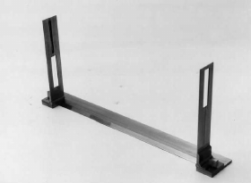
The process involves placing the plane table on a level surface and orienting it to the true north using a compass or the sun. Then, the surveyor uses a sighting device called an alidade to take measurements and make observations of the site, such as distances, angles, and elevations.
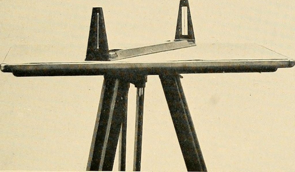
The measurements are recorded directly onto the map sheet attached to the plane table, allowing the surveyor to create an accurate and detailed representation of the area being surveyed. This method is particularly useful for mapping small to medium-sized areas with irregular topography, as it allows for a clear and comprehensive view of the terrain.
Plane table surveying requires skill and attention to detail, as errors in the field will be reflected in the final map or plan. However, it is a relatively simple and fast method of surveying that has been used for centuries and is still used today for various mapping and surveying applications.
Equipment Used in Plane Table Survey
Plane table surveying can be accomplished with the following equipment:
- Plane table
- Alidade for sighting (telescopic or simple)
- Plumb bob and Plumb fork
- Compass
- Spirit level
- Chain
- Ranging rods
- Tripod
- Drawing sheet and drawing tools
- Paper clips or screws
Procedure to Carry Out Plane Table Surveying
There are several methods of plane table surveying, and to choose the appropriate method for surveying, one needs to consider factors like required accuracy, survey area size, complexity, available resources and equipment. The traverse, radiation, and intersection methods are commonly used. Therefore, one can consider the following steps to carry out the survey.
- Setting up the table: The table is set up at the survey site, and it is levelled using a spirit level. The table should be set up on a stable platform, such as a tripod, to ensure it remains steady during the survey.
- Orienting the table: The table is then oriented to true north using a compass or by sighting a known point. This step is important to ensure that the survey data is accurate.
- Stationing: The next step is to station the plane table at a point on the site, and then take readings of the angles and distances to various features in the survey area.
- Sketching: Using the table as a reference, the surveyor then creates a sketch of the site, showing the features and their relative positions. This can be done directly on the table surface or on paper attached to the table.
- Plotting: The surveyor then uses the sketch to plot the survey data onto a map or plan. This involves transferring the angles and distances measured on the table to a scaled drawing of the site.
- Calculation: Finally, the surveyor calculates the coordinates or elevations of the features surveyed, based on the map or plan created in the previous step.
Errors in the plane table survey
- Instrumental errors.
- Errors in plotting.
- Errors due to manipulation and sighting.
Instrumental errors
Instrumental errors are the primary source of errors in plane table surveying.
Errors in Plotting
These errors may occur due to plotting
Errors due to manipulation and sighting
Errors of manipulation and sighting come under personal errors or man-made errors.
Advantages of Plane Table Surveying
The advantages of using the plane table in surveying are-
- It is the most used and suitable method for surveying and preparing small-scale maps.
- All possible human and machine errors can be eliminated as the surveying and plotting are done simultaneously in the field.
- Plane table surveying finds its importance in places with high magnetic fluctuations where compass survey is not reliable.
- This type of survey does not use a machine, so it is less costly than most surveying techniques.
- It is one of the most rapid surveying techniques.
- Errors occurring due to mistakes in the field book entry are eliminated.
- Contours and other irregular objects may be accurately represented on the map since the tract is in view.
- It does not require skilled personnel to plot the map.
- The errors and mistakes in plotting can be checked by drawing check lines.
Disadvantages of Plane Table Surveying
The disadvantages of the use of the plane table in surveying are-
- The process of shifting and re-orienting the plane table from one place to another is very lengthy.
- This type of surveying is not feasible in rainy and windy areas as the plotting work is done in the field itself.
- The plane table and its accessories are heavy and difficult to carry
- The accuracy achieved in other types of surveying is higher than the accuracy achieved by plane table surveying.
- If the survey is to be re-plotted to a different scale or quantities are to be computed, it is a great inconvenience in the absence of the field notes.
- It is not suitable for surveying large areas.
- Where the magnetic fluctuation of the compass is very height, the surveying can not be conducted.
- This method of surveying is not suitable in dense forest areas as the trees block the view of other important components of the field.
- This method of surveying can only be done in the daytime.
Also, read: Distance Measurement With Measuring Tape: Corrections & Errors
FAQs:
Q: What is plane table surveying?
A: Plane table surveying is a popular and appropriate method for surveying and creating small-scale maps. Simultaneously surveying and plotting in the field eliminates all possible human and machine errors. This method is particularly useful in areas with high magnetic fluctuations where compass surveying is not reliable. Compared to other surveying techniques, plane table surveying is less expensive as it does not require the use of machines. Additionally, it is one of the fastest surveying techniques. Mistakes in the field book entry are eliminated, and contours and other irregular objects can be accurately represented on the map since the tract is in view. Plotting the map does not require highly skilled personnel. Finally, errors and mistakes in plotting can be checked by drawing check lines.
Q: What are the methods of plane table surveying?
A: The methods of plane table surveying are:
1. Radiation method
2. Intersection method
3. Traversing method
4. Resection method
Q: What are the advantages of a plane table survey?
A: The advantages of plane table surveying are:
1. It is the most used and suitable method for surveying and preparing small-scale maps.
2. All possible human and machine errors can be eliminated as the surveying and plotting are done simultaneously in the field.
3. Plane table surveying finds its importance in places with high magnetic fluctuations where compass survey is not reliable.
4. As this type of survey does not use a machine, it is less costly than most types of surveying techniques.
5. It is one of the most rapid surveying techniques.
6. Errors occurring due to mistakes in the field book entry are eliminated.
7. Contours and other irregular objects may be accurately represented on the map since the tract is in view.
8. It does not require skilled personnel to plot the map.
9. The errors and mistakes in plotting can be checked by drawing check lines.
Q: What are the common errors in plane table surveying?
A: The common errors in plane table surveying are:
1. Instrumental errors.
2. Errors in plotting.
3. Errors due to manipulation and sighting.
![]()

