The level of any surface plays an important role for the engineer, architecture and surveyor without which it becomes a little difficult for planning, designing and construction. One of the methods of finding the level of the ground is by using the levelling instrument. This article is about dumpy level.
What is Dumpy Level?
It is an optical instrument used for carrying out levelling operations and picking the point from the ground in the same horizontal plane. The instrument is also called an automatic level or builder’s level. It comprises a telescope tube, firmly held between two collars and adjusting screws. The complete instrument is staged by the vertical spindle.
The use of dumpy level can determine elevations of different points and the distance between the points of the same elevation.
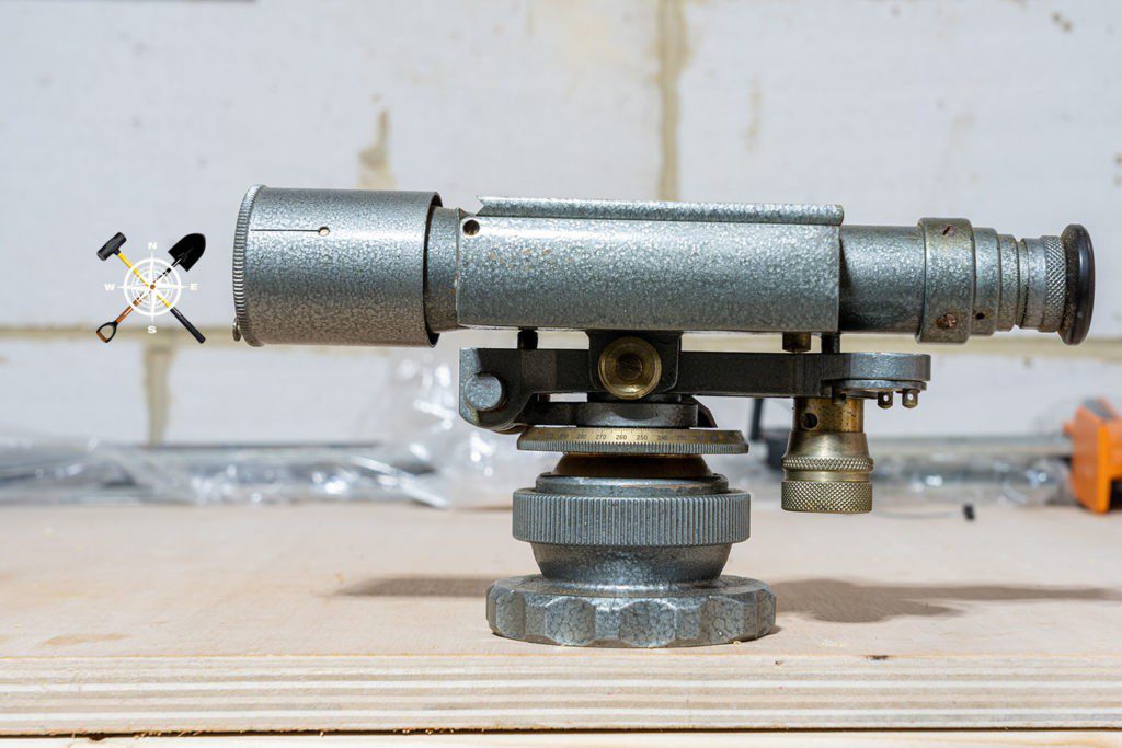
History of Dumpy Level.
Since the discovery of the Dumpy level in the 19th century, the instrument was used to check the level of construction sites, and road crossing sections. The Dumpy Level was invented in the year 1832 by Willian Gravatt from England.
Also, read: The instrument for Chain Surveying
Principle of Dumpy Level Instrument.
The telescope placed on the machine can be rotated along the horizontal plane. Therefore, the relative elevation of the topographic terrain can be determined through dumpy-level surveying.
The dumpy level works on the principle of establishing a visual relationship between two or more points, through a built-in telescope and levelling bubble. It is also known by various names such as Surveyors Level, Builders Level, Dumpy Level, or even its prehistoric version “Level Y (wye) level”.
Components.
The whole set-up of dumpy-level equipment consists of a telescope, tribrach, compass, vertical spindle and tripod.
Telescope:
The telescope is used for measuring the distance between the objects/points in the line of sight. The telescope is generally connected with a vertical spindle, facilitating the telescope to be movable in various directions. The telescope comprises various parts; all the parts are described below.
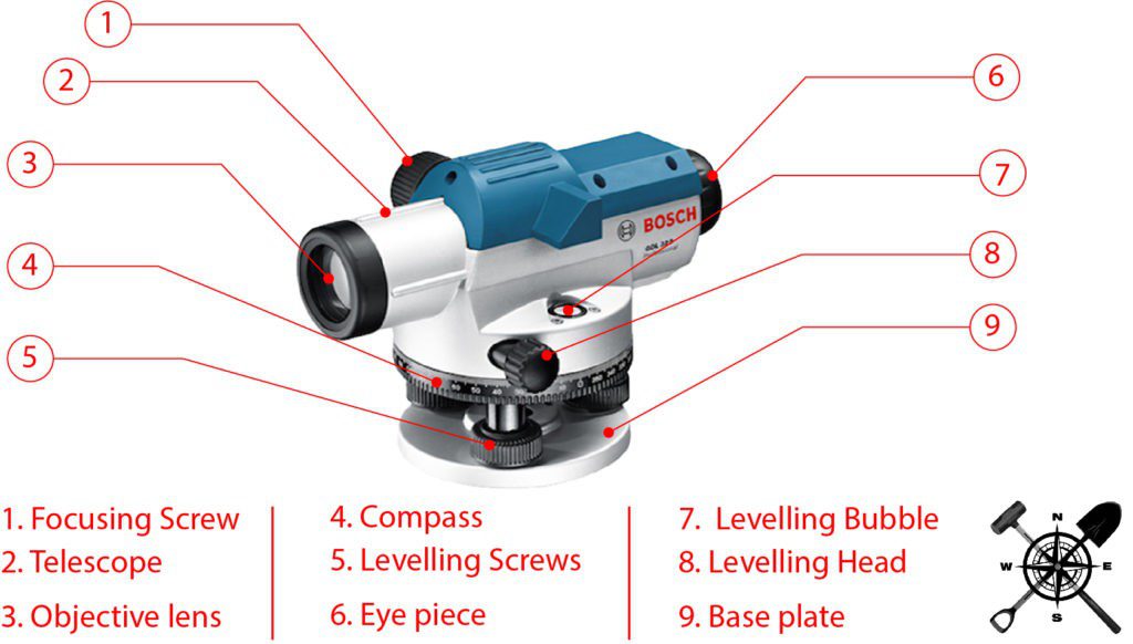
Eye Piece: It comprises a magnifying glass and is primarily used by the observer.
Objective Piece: it is placed at the farther end of the eyepiece. It comprises a convex lens and a concave lens.
Diaphragm: Provided in the outline of the eyepiece with the cross of dark metal. They are provided to bisect objects.
Focusing Screw: They are meant to align the focus and image clarity of the object.
Ray Shade: Prevents sunlight from entering the objective lens.
Vertical spindle
The vertical spindle is located at the centre of the whole instrument. The telescope can be rotated in the horizontal direction with respect to the vertical spindle. The instrument is connected to the tripod stand using a vertical spindle.
Tribrach
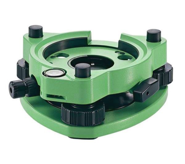
The Tribrach plate is parallel to the levelling head or trivet. It is connected to a trivet by levelling screws or foot screws which can adjust the tribrach plate. The horizontal level of the instrument can be achieved by adjusting this tribrach plate.
Foot screws
Foot screws are provided to regulate the tribrach position and hence the instrument can be levelled which is known by observing the bubble tube. The tribrach plates can be lowered or raised using foot screws. The position of the tribrach is said to be correct when the bubble in the bubble tube is at the centre.
Levelling head
The levelling head is also called a trivet. It contains two triangular-shaped plates which are arranged parallel to each other. Three groves are provided at the three corners of the plates in which foot screws are supported.
Tripod
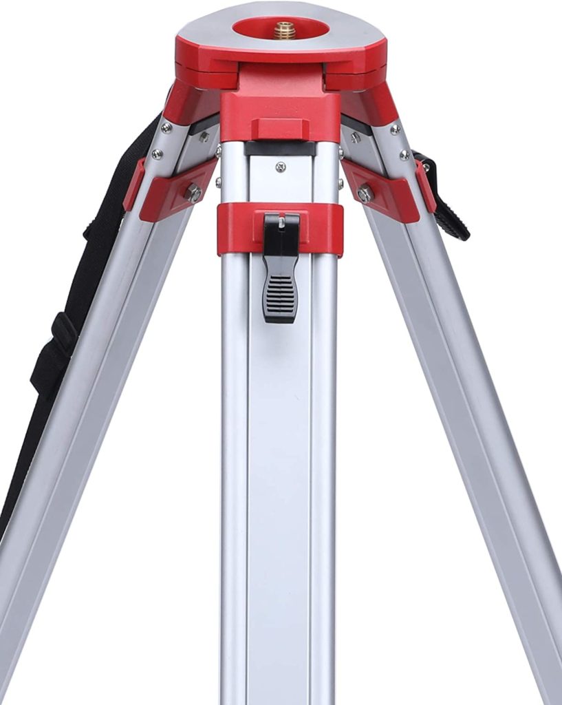
A tripod is used to support the whole levelling instrument on its top. It consists of three legs which can be adjustable to the required position. The legs are of the same height and they may be solid or hollow. Steel shoes are provided at the bottom of each leg to hold the ground in a fixed position.
Also, read: Theodolite Surveying | 2 Types of Adjustments | Errors
Accuracy of the instrument
The device is known for high accuracy values for most of the Tachometric methods. The accuracy of a machine level can be within 1:4000 for every 100 m.
Application in Surveying
- To determine the relative height and distance between various locations of surveying land.
- To determine the relative distance between several locations of surveying land.
Uses for Surveying.
The device holds significant importance in surveying a construction site. The accuracy and handedness of the instrument have made it a prominent choice among surveyors.
- The prime reason for performing levelling on a construction site is to make the field level and even.
- For determining the differences in height between two points.
- To measure the height and distance of different locations of surveying land through the principle of relativity.
- To measure the following distance among various points on the surveying land.
- Setting out levels and inclined surfaces for construction.
- To draw contours on land.
Benefits of Dumpy Level Surveying
- Level readings are very accurate.
- The instrument is easy to use.
- Adjustments can be made as per the requirement on any type of ground.
- Optical power is high
- The device is cheaper than other instruments.
Drawbacks of Dumpy Level Surveying
- It is limited to only horizontal angle measurement.
- The angles obtained by Dumpy are not that accurate.
- Vulnerability to errors caused by atmospheric conditions and instrument calibration.
- Difficulty in surveying steep slopes or inaccessible areas.
Also, read: What is GNSS RTK Surveying?
FAQs:
Q. What is dumpy level?
Answer: A dumpy level is an optical instrument used for surveying and levelling operations. The instrument is popularly used for levelling and picking the point from the ground in the same horizontal plane. It consists of a telescope tube, firmly held between two collars and adjusting screws. The complete instrument is staged by the vertical spindle.
Q. What is dumpy level surveying?
Answer: Dumpy level surveying is a technique used in land surveying to determine the relative heights or elevations of different points on the ground. It involves the use of a dumpy level, which is a type of surveying instrument that combines a telescope and a spirit level.
Q. What is the principle of the dumpy level?
Answer: The dumpy level works on the principle of establishing a visual relationship between two or more points, through a built-in telescope and spirit level.
Q. What are the limitations of dumpy level surveying?
Answer: Some limitations of dumpy level surveying include:
a. Limited accuracy compared to more advanced surveying instruments.
b. Vulnerability to errors caused by atmospheric conditions and instrument calibration.
c. Difficulty in surveying steep slopes or inaccessible areas.
![]()


